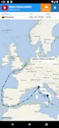
[App] VesselFinder

VesselFinder features include:
Real-time tracking of over 200,000 ships every day
Ship search by Name, IMO number or MMSI number
Ship movements history
Ship details – name, flag, type, IMO, MMSI, destination, ETA, draught, course, speed, gross tonnage, year of built, size and more
Port search by Name or LOCODE
Port Calls per ship – time of arrival and stay in ports
Port Calls per port – detailed list of all vessels Expected, Arrivals, Departures and currently In Port
My Fleet – add your favourite vessels to “My Fleet,” synchronised with your VesselFinder account
My Views – save your favourite map views for quick navigation
Ship photos contributed by VesselFinder users
Simple, Detailed, Dark and Satellite maps
Weather layers (temperature, wind, waves)
See Your Location feature
Distance Measure tool
IMPORTANT:
If you experience any problem with the App, please fill this form to contact us http://www.vesselfinder.com/contact instead of writing a review here. We will do our best to solve it. Thanks!
Visibility of vessels in the App depends on AIS signal availability. If a particular vessel is out of our AIS coverage zone, VesselFinder displays her last reported position and updates it as soon as the vessel comes into range. Completeness and accuracy of the information provided cannot be guaranteed.
Connect with VesselFinder
on Facebook: www.facebook.com/vesselfinder
on Twitter www.twitter.com/vesselfinder
You may also like timestation app
VesselFinder user reviews :
Besides the obligatory ads and urges to pay $100+ per year… not bad! Not up to date; but they’re at the behest of the vessel owners, no way around personal privacy. Needs a call to arms for photo submissions and verifications of contributor data. SUGGESTION: Add a ‘next’ button that displays the next closest ship in the area; i had issues that stacked the dots, i couldn’t get the data from 3 of 4 markers.
I’ve lost all the names of the fishing vessels I follow ,which stops me following there track and there distance out to sea , but only in my area . I can see all the vessel names a few hundred km of where I live . Has this site changed its user settings . It use to be a great site but if it won’t let me in , time to change.
They are trying to get people to pay more I guess. It’s now 13 days my AIS has been detected, although I have been well within range of coasts and of course picked up by satellites. Satellite subscription is prohibitive in any case.
Good job for looking at my senyar when I lose them, and thank Unfortunately, this program was very useful, especially since it was free, and now it is subscription-based, and I can only enter for free.
Opens up a whole new world when sitting having coffee on the hotel terrace where I live in Lowestoft. Tracks all sizes from wind farm support craft to the largest contaner ships heading for Felixstowe. Also great on my holiday to Ireland. Very addictive.
Inconsistent information displayed : I’m tracking 2 ships that are travelling together. When I do a search for one, the second one doesn’t appear on the map (they are 5-10 miles apart) and when I search the second one, the first one disappear from the map (1min between the 2 search). Also other ships around don’t have the same position between the 2 search… Happy to review my rating when this is fixed or explained
If you spend time on the water around Commercial Boating/Shipping this is a must. If you can read a chartplotter, You can easily identify any AIS equipped vessel to communicate with and maintain safe distances. If you can’t read a chartplotter you shouldn’t be playing around Commercial vessels in the first place … Great App.
If you have a view of shipping lanes it’s invaluable. Lots of information and pictures of the vessels. Fascinating to see wherebtheve come from and going to. Was particularly helpful when in lockdown. You realised there was still a world out there!
It’s a good app as it shows me What vessels are where. I live near a Small port and the ships are regular visitors to it. I can easily see where they’re going and can track them. I can also see other ships and the photos of some of them are incredible Sometimes. I hope to be able to have a boat. In the future. And. This app will come in very handy for finding ports to call to.
Have recently been on a cruise and every time I checked vessel finder app, the reported position of our ship seems to tally with what I can see out the window / my phone’s GPS, so can’t see why people are saying the ship’s positions aren’t up to date. The app works well and I find it easy to locate ship’s I’m interested in, or find out what the ship on the horizon is.
Contact developer :
Download VesselFinder from Play Store
Leave your feedback regarding VesselFinder
