Uber Fleet – Track and monitor the status and safety of your drivers and cars
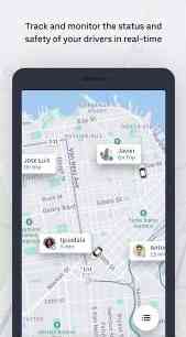
[App] Uber Fleet Introducing the new design of the Uber Fleet app for Android! The Uber Fleet app provides Uber Partners with world-class tools to operate their businesses more efficiently — all from your mobile device! With the Uber Fleet app, Partners can: Track and monitor the status and safety of your drivers and … Read more