[App] Avenza Maps – Offline Mapping
 Avenza Maps, the best app for hiking, biking and all trails. Featuring maps from National Geographic, national parks and more!
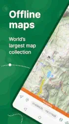
On your next adventure, stay on track with GPS using offline mobile maps. Make your own maps? Import your custom maps and never get lost off the grid.
Explore the largest mobile Map Store of hiking, topographic, cycling, city, nautical, travel, and trail maps. Featuring maps from professional publishers including National Geographic, National Park Service, and the US Forest Service. Discover maps for your next camping, fishing, or backpacking trip with your family and friends. Navigate confidently when off-roading or taking those backcountry trails. Precisely identify your location with what3words and stay safe wherever you are.
Avenza Maps is free and the best map app for recreational use. Maps are available for free or purchase from the in-app Map Store. Plus subscription is available for unlimited custom map imports. Pro subscription is available for professional users with full access to all features and mapping tools.
Avenza Maps for your offline adventures on all trails!
ENHANCE YOUR MAPS WITH THESE FEATURES
Locate your realtime GPS position and find direction, even when offline
Record GPS tracks during your activities
Navigate to features using compass tools
Add photos and notes to any location
Add placemarks to your map and style them with recreational symbols
Measure distances and estimate times
Supports KML, GPX, and CSV Formats
EXPLORE THE MAP STORE
Search and download maps by activity, category, and specific publishers with premium maps from:
National Geographic
Michelin
Backroad Mapbooks (BRMB)
New York-New Jersey Trail Conference
USFS (United States Forest Service)
USGS (United States Geological Survey)
FAA (Federal Aviation Administration)
NOAA (National Oceanic and Atmospheric Administration)
BLM (Bureau of Land Management)
HarperCollins
DeLorme Atlas & Gazetteer / Garmin
BaseImage
National Park Service
And thousands more!
A free account lets you access all of your map downloads.
GET MORE WITH AVENZA MAPS PLUS
For recreational and power users who need more
Unlimited import of your own geospatial PDF, GeoPDF®, and GeoTIFF maps
Create geofences for up to 50 individual features and up to four geofence layers
GET EVEN MORE WITH AVENZA MAPS PRO
For professionals and organizations who require an offline mapping solution with location awareness with more features and tools
Unlimited import of your own geospatial PDF, GeoPDF®, and GeoTIFF maps
GPS averaging, additional coordinate display formats, custom symbol sets
Connect high-accuracy GPS devices including Trimble, Bad Elf, and Dual via Bluetooth
Created unlimited geofences and get global geofence notifications
Convert tracks to areas
Map orientation lock
Import and export Esri® Shapefiles
Import and manage custom symbology sets
Priority technical support
Avenza Maps Pro subscription required for commercial, academic, government, and professional use.
SUPPORT
We can help! Go to support.avenzamaps.com
LEGAL
Privacy Policy: avenzamaps.com/legal/privacy-policy.html
Terms of Use: avenzamaps.com/legal/terms.html
CONNECT WITH US
avenzamaps.com
facebook.com/avenzamaps
twitter.com/avenzamaps
instagram.com/avenzamaps
You may also like timestation app
Avenza Maps user reviews :
I’ve always liked the aspect of Avenza that provides navigable, downloaded maps because connectivity isn’t always there. I haven’t used it that much because there aren’t always free maps for my immediate purpose, but this beta with OSM looks like a big deal to me. The app itself seems to be reliable and I like how they’ve made content easier to find.
I just started using Avenza Maps. I was looking for an app that would be accessible offline, and this seems to fit the criteria. I’ll be using it in conjunction with GAIA to see how they compare. I appreciate that most maps I need are free. I’ll re-evaluate and post after I’ve had an opportunity to use it both on and off line. Happy hiking and safe travels.
Use it for work (Forestry) and personal. Easy to use, accurate tracking and ability to capture photos into individual POI is awesome. Ads don’t clutter, I recommend the Avenza plus package if you’re using it more than once a week to capture multiple active maps. If youre capable of accessing a program like GIS then the Pro would be the best choice for uploading shapefiles and polygonal information. Interface on the app is spectacular and give huge applause to the creators and coders of this ap
Excellent GPS mapping app. National parks and related maps are free in their “store” which I have used several times. My state of MN also has several free park maps. When you’re backpacking or camping it has been invaluable, making my life much easier to see where you are via GPS overlaid a predownlpaded map. When you have one of these maps in backcountry, you won’t get lost.
Works great. Got the app because my local trail system map would only work with it, but it works pretty well. I like that it will let me use the UTM coordinates instead of just lat/long. I didn’t like that the default for the map compass was magnetic north, but that was easy to change in the settings.
Contact developer :
Download Avenza Maps from Play Store
Leave your feedback regarding Avenza Maps
You can find our crypto wallets on https://free-apps-android.com/buy-us-a-coffe/
Sponsored Links


