[App] AlpineQuest GPS Hiking changed to AlpineQuest Explorer Lite
 AlpineQuest is the complete solution for all outdoor activities and sports, including hiking, running, trailing, hunting, sailing, geocaching, off-road navigation and much more.
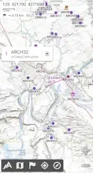
You can access and store locally a large range of on-line topographic maps, which will remain available even while being out of cell coverage. AlpineQuest also supports many on-board file-based raster map formats.
By using the GPS and the magnetic sensor of your device (with compass display), getting lost is part of the past: you are localized in real-time on the map, which can also be oriented to match where you are looking at.
Save and retrieve unlimited placemarks, share them with your friends. Track your path, get advanced statistics and interactive graphics. You won’t have anymore questions about what you can accomplish.
By staying fully operational out of cell coverage (as often in mountain or abroad), AlpineQuest assists you in all your desires of deep wilderness exploring…
No advertisements ~ No data monetization ~ No analytics ~ No third party libraries
Don’t hesitate, use it right now for free!
PLEASE report suggestions and issues on our dedicated forum www.alpinequest.net/forum (no registration needed, all questions answered) and not in comments.
Key features are (for full version):
Maps
Built-in online maps (with automatic local storage; road, topo and satellite maps included) and online layers (road names, hillshade, contours);
Get more online maps and layers in one click from the included community maps list (all major worldwide maps and many local topo maps);
Complete area storage of online maps for off-line use;
On-board offline maps support (raster) including KMZ Overlays, OziExplorer OZFx2, OZFx3 (partly) and calibrated images, GeoTiff, GeoPackage GeoPkg, MbTile, SqliteDB and TMS zipped tiles (visit our website to get MOBAC, the free map creator);
QuickChart Memory Map support (.qct maps only, .qc3 maps not compatible);
Built-in image calibration tool to use any scan or picture as a map;
Digital elevation model on-board storage (1-arcsec SRTM DEM) and support for HGT elevation files (both 1-arcsec and 3-arcsec resolutions) allowing display of terrain, hillshade and steep slopes;
Polar maps (Arctic and Antarctic) support;
Multiple maps in layers display, with per-map opacity/contrast/color/tint/blending control.
Placemarks
Create, display, save, restore unlimited number of items (waypoints, routes, areas and tracks);
Import/export GPX files, Google Earth KML/KMZ files and CSV/TSV files;
Import ShapeFile SHP/PRJ/DBF, OziExplorer WPT/PLT, GeoJSON, IGC tracks, Geocaching LOC waypoints and export AutoCAD DXF files;
Save and share online locations with other users using Community Placemarks;
Details, advanced statistics and interactive graphics on various items;
Time Controller to replay time-tagged tracks.
GNSS Position / Orientation
On-map geolocation using device GNSS receivers (GPS/Glonass/Galileo/…) or Network;
Map orientation, compass and target finder;
Built-in GNSS/Barometric track recorder (long tracking capable, running in a separate and light process) with battery level and network strength recording;
Proximity alerts and leave path alerts;
Barometer support (compatible devices).
And more:
Metric, imperial, nautical and hybrid distance units;
Latitude/Longitude and grid coordinate formats (WGS, UTM, MGRS, USNG, OSGB, SK42, Lambert, QTH, …) with on-map grids display;
Ability to import hundreds of coordinate formats from www.spatialreference.org;
You may also like morecast app
AlpineQuest user reviews :
Fantastic app. I am hopeless in reading maps but feel safe to walk wherever I want as I can always find my way back. Happy to have it
A useful App for working in a remote environment in which there are few maps and communication is often difficult.
It is still a very good app. However, in recent updates of the free version the isohypse lines have disappeared! For anyone wishing to have a feel of the environment on the flat map this information is apsolutely crucial. It is indispensable if one is using the app for actual walking. This app should remain a walkers’ app. Google maps are for those who are content with a virtual helper saying ‘turn left after….’, ‘turn right at..’. A true walker reads a map on her/his own. Thank you
This is perhaps the best app for a hiker available in the market. I only found one problem during navigation. If the screen turns off for about 10 seconds, and you turn it on again, the GPS freezes in the last position. That is rather annoying. I tried letting work in the background, auto on, remove the battery saver. I could not solve the problem. Could it be possible to adapt the program in such a way that if the GPS slider is active, the program reactivates the GPS any time the screen is on?
I found this app while looking for a replacement for Viewranger, which I’ve been using for many years. It is the best outdoor navigation app for Android bar none. Small, fast, and with an interface that is obviously designed by people that use it outdoors in anger on a daily basis. Highly recommended and the Pro version is well worth your money.
Contact developer :
Download AlpineQuest from Play Store
Leave your feedback regarding AlpineQuest
You can find our crypto wallets on https://free-apps-android.com/buy-us-a-coffe/
Sponsored Links


